
Trace a Virginia Street by Address
Start with the full address and the locality that governs it. Virginia has 95 counties and 38 independent cities, and towns sit within counties. A postal city is not enough to choose a records office. Use the Virginia local-government finder to identify the county, city, or town connected to the address, then keep that locality with every result.
Walk from the present parcel toward older records. Each source adds a different kind of evidence, so save the date and the exact field names rather than treating every name as a resident list.
- Enter the address in the locality's assessment or GIS search. Save the parcel ID, owner-of-record fields, situs address, and last-update date.
- Check the local assessment card for the tax record and compare its mailing address with the physical parcel address.
- Search the circuit-clerk land index by parcel reference and owner name to find the deed and any prior instrument reference.
- Check the Virginia voter-list access rules before using any public election record. Those files are not an open street sweep.
- For an earlier household, compare address indexes, maps, census schedules, and newspapers by year, then seek the original page or record.
This order keeps today's parcel separate from the names attached to it in other years. The street directory question is often a chain of records, not one search result.
Virginia Parcel Data Along Streets
The statewide VGIN VA_Parcels layer makes parcel geometry and a shared set of address fields available across locality feeds. It can help locate a lot, compare nearby parcels, and carry an identifier into the proper local tax or deed system. Its data date varies by locality, and it is not a certified assessment card.
The Virginia GIS Clearinghouse is the statewide entry point for map services and downloads. The parcel layer separates the physical situs address from the tax mailing address, which may point to a different place.
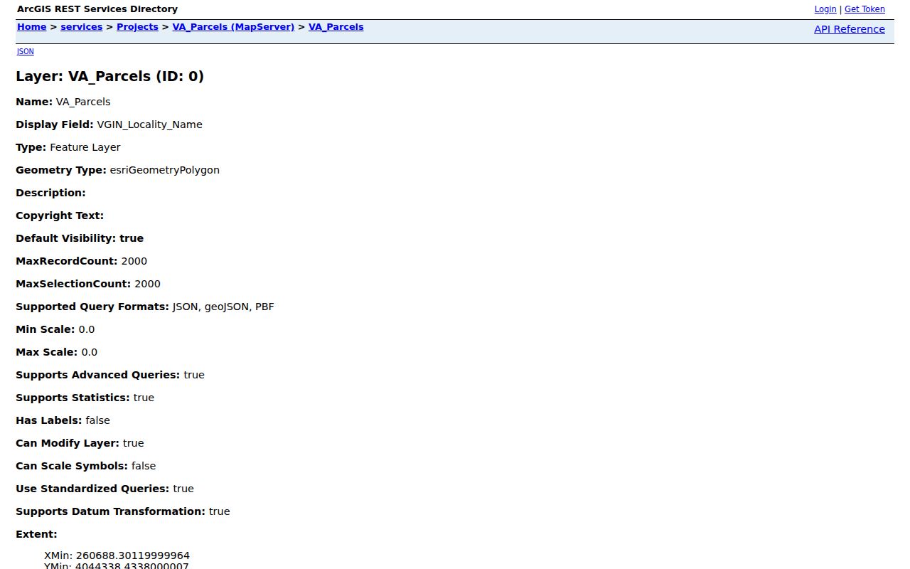
Use the map to find a parcel and its locality, then confirm ownership and assessment details with the local commissioner or assessor.
Virginia Assessor Search Fields
There is no single statewide Virginia assessor search form. Each county or independent city sets its own portal and search labels. A local search may take an owner name, street number and name, parcel or account number, map number, subdivision, or legal description. VGIN standardizes several result fields, but it does not replace the local tax card. That is why a Virginia street directory search still needs the local assessment card after using VGIN.
| Field or control | Type | Use and limit |
|---|---|---|
| Owner name | Text or autocomplete | Common local search; the displayed owner is not a list of occupants. |
| Situs or property address | Text or separate number and street fields | Searches where the parcel sits, not where tax mail goes. |
| Parcel, PIN, GPIN, or map number | Text or account lookup | Use the identifier from a map result; formats can differ after a split or merger. |
| Locality | Local portal choice or fixed site | Select the county or independent city before searching; a postal city may not match. |
| ZIP | Optional text or map filter | VGIN exposes a ZIP field; many local tax portals do not search an entire ZIP. |
| Mailing address and last update | Result fields | Compare tax correspondence with situs and note when the feed was refreshed. |
A sample VGIN result has enough fields to cross-check a parcel with the local card and deed index. Preserve the retrieval date as well as the values:
- Locality and parcel identifiers: VGIN_QPID, FIPS, LOCALITY, PARCELID, PTM_ID, GPIN, PIN, and MapNumber.
- Owner-of-record fields: Owner1 and Owner2.
- Situs fields: Address, City, State, and Zip.
- Tax-mailing fields: M_Address, M_City, M_State, and M_Zip.
- Map shape and freshness: geometry and LASTUPDATE; the service does not include a deed image or full tax-payment history.
- Parcel
- A mapped piece of land with an identifier used by local tax and deed systems.
- Situs address
- The street address where the land is located; it may differ from the tax mailing address.
- Plat
- A recorded survey or subdivision map that shows lots, blocks, easements, or road lines.
- Criss-cross directory
- An address-to-name index for the years and places covered by that volume.
Virginia Street Records and Access
Several custodians keep address-keyed material in Virginia. A street directory search should keep the owner, parcel, deed, permit, voter, and older household questions apart because each record has its own coverage and access rule.
| Record set | Keeper | What it can add | Access route |
|---|---|---|---|
| Assessment card | Local commissioner or assessor | Owner, situs and mailing address, parcel ID, values, exemptions, and local history where offered | Local portal, counter, phone, or written request |
| VGIN parcel layer | VGIN and locality data feeds | Parcel shape, owner and address fields, identifiers, locality, and update date | Public map service; verify with locality |
| Deed and plat | Local circuit court clerk | Parties, recording date, instrument number, legal description, lot lines, or easements | SRA index, local terminal, clerk copy, or LVA microfilm |
| Tax account | Local treasurer or commissioner | Tax bill, payment history, delinquency, or tax-sale notice where held | Local portal or request to the treasurer |
| Permit or code file | Local building, planning, or code office | Project address, applicant or contractor, dates, inspection, and case outcome where public | Local portal, counter, or request |
| Past address evidence | Libraries, LVA, newspapers, and archives | Dated occupants, buildings, street names, or public events | Online indexes, library holdings, microfilm, and reference help |
The local assessment card is the tax record; the deed is the title record; a map connects the parcel to land around it. A single record rarely answers all three questions. For covered public bodies, Virginia FOIA requests should describe an existing record clearly, since an office does not have to create a new list.
Virginia Deeds Along a Street
The circuit court clerk in each county and independent city holds local land records. The Virginia Circuit Court Secure Remote Access (SRA/COVERS) system shows which clerks enable free index-only access. Image access is controlled by each clerk and can require an agreement, subscription, and fee; in-person inspection remains an option under Virginia Code § 17.1-208.
The SRA interface is locality-dependent, and no single statewide cutoff year or uniform live search form was found. These controls are the documented starting points, not a promise that every clerk exposes each field online.
| Search control | Type | Use or limit |
|---|---|---|
| Available Courts | Locality list | Choose the county or independent city; participating clerks differ. |
| Name or party | Text | Search grantor and grantee names, including spelling variants. |
| Instrument type | Local dropdown or filter | Deeds, plats, liens, judgments, and other indexed types vary by clerk. |
| Date range | Date pair | Narrow recording dates when available; no uniform default was located. |
| Instrument, book, or page | Text | Carry forward a reference from the assessment card or prior deed. |
A usable deed-index result should be logged before requesting the image or clerk copy:
- Locality or court, grantor, and grantee.
- Instrument or document type, plus recording date.
- Book and page or the clerk's instrument number.
- Legal-description reference and any prior instrument link.
- Image availability, subscription rule, and copy route.
A deed-index result is a lead, not a certified deed. Note the court, grantor, grantee, instrument type, recording date, book/page or instrument number, legal-description reference, image status, and copy route. If the online index stops, call the clerk and ask about the public terminal, older deed books, copy fees, and any transfer to the Library of Virginia. The Virginia circuit-court directory helps route a request to the right clerk.
Virginia Permits by Street Address
To browse a whole street, use the local assessor's street-name search if offered, or open a locality GIS viewer and move along the mapped parcels. The VGIN service can be queried by locality and address fields, but a broad result must be narrowed and paged; the service caps a response at 2,000 records. Local GIS may add zoning, floodplain, historic, election, or service-area layers. Those are local layers, not a guaranteed part of VGIN.
Building permits and code cases add dated evidence about work at a property. A local file may show the permit type, applicant, contractor, status or inspection date, and project description. Virginia Permit Transparency covers participating state-issued permits; it does not replace a locality's building, zoning, or code office. If the local permit page is absent, the DHCD building-official directory provides a locality contact route.
Virginia Voter Data by Address
Virginia does not offer an open voter search that sweeps names by street address. Public voter list products follow a separate route. State law limits who may receive them, which fields are included, and how they may be shared.
Lists may show name, address, year of birth, gender, and election districts when supplied through a permitted product or inspection. They exclude SSNs, day and month of birth, protected residence addresses, and other restricted registration information. The law also bars publishing a voter list online as a searchable database. Use the Department of Elections or the local general registrar for the correct access route; the Virginia voter-list statute sets out recipient limits.
A voter entry can help verify a lawful, dated address connection, but it cannot establish every person on a block. An omitted or substitute address may reflect a safety protection rather than a failed search.
Virginia Street Names and Locality Lines
Virginia has no statewide street-history file or common renumbering schedule. Localities can annex land, rename a road, change house numbers, or shift the boundary that defines the records office. A town name or postal city may differ from the county or independent city that holds the parcel, and rural route descriptions may not match a later standardized address.
For an older deed, keep its original wording. Compare the legal description, plat, historic map, old tax map, directory street index, and post-office clue before deciding it matches a present address. Use USPS address lookup for postal formatting, then check VGIN's locality field for the legal records jurisdiction. A ZIP code can cross county, city, town, or state lines, so postal geography does not settle ownership or jurisdiction.
Reading Virginia's Historic Street Trail
Older address evidence is scattered among local libraries, the Library of Virginia, maps, newspapers, and census schedules. LVA's Ancestry for Virginians describes a collection of city directories from 1873 to 1960, with gaps and locality differences. A criss-cross volume can lead from an address to a printed name, while a name index can help find the same household under a different spelling.
Sanborn maps date from 1867 in Virginia, but exact towns and years vary. They show building footprints, use, materials, and street context, not title ownership. The Library of Virginia map collection index helps locate available maps. Census schedules, directories, maps, and newspapers should be compared by date and locality; a similar name or number alone is not proof of a match. The National Archives census guide explains the public year range and household schedule context.
The older volumes and how to read their entry marks belong with the Virginia city directories collection page. For a street study, carry only the dated address clue back into the present parcel chain.
What a Virginia Street Directory Cannot Show
No statewide public tool provides a complete list of everyone who lives along a Virginia street. Parcel data names owners of record, not all people who occupy a home. Voter access is limited, motor-vehicle data is protected, and utility or delivery records are not open street rosters. A missing match may reflect a different locality, a changed address, a private record, or a protected address.
Use a record only for a specific, lawful personal question, and stop when a source reaches a confidential address or details about a person who is not part of the record question. When an online result is incomplete, ask the named custodian for the index cutoff, public terminal, paper record, or copy process instead of treating silence as proof.
Lawful use. Virginia records can support personal, civic, and family-history research. Do not use address details to stalk, harass, threaten, or expose another person.